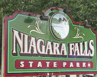
Wednesday, September 4, 2013
EEK!!! Trying to plan our route, catch up on my blog and sightsee can be overwhelming, there's just never enough time. I don't always trust our GPS so I like to plot our route on Streets and Trips or look at the overall picture in the atlas. We like to stay off the interstates as much as possible and use state highways because they are much more scenic. It may be a little slower because of all the little towns but we're not in that big of a hurry so it works for us. We have had a couple of days of relaxation in Gasport, New York, in preparation for our arrival in Jersey City on Saturday, Sept. 7, for our New York City adventure. I am looking forward to not having to make any decisions as to where we want to go, what we want to see or when we want to see it. Those decisions will be made by Fantasy RV Tours, the company we booked our rally through.
 |
| American Falls on left and Horseshoe Falls on right - Lee's iPhone took a terrific panoramic shot! |
 |
| Rainbow Bridge between U.S. and Canada(on left) |
 |
| Viewing platform near American Falls |
 |
| Waiting to get on Maid of the Mist boat ride at Niagara Falls. The blue plastic ponchos were definitely needed, just not this soon - it was too hot and humid! This is only half the people on our tour boat. |
 |
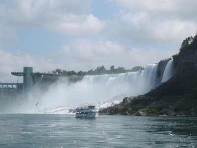
| We're getting closer to American Falls |
 |
| We're really close to American Falls and the mist is getting heavier and it's getting windier - time to put the camera away |
 |
| The next boatload of people ready to get wet! |
 |
| I guess I didn't put the camera away soon enough, that's a drop of water in front of my face! |
 |
| American Falls |
 |
| One more shot of American Falls and the viewing platform |
 |
| American Falls in the foreground; mist in the background is from Horseshoe Falls |
 |
| On the Cave of the Winds walkway, Niagara Falls State Park, New York - one could almost touch the falls. From here it's up to the Hurricane Deck where Bridal Veil Falls create tropical storm-like conditions with winds up to 68 mph. A cave was discovered in 1834 behind the fall and tours began officially in1841 until 1920 when a rock fall caused it to be closed because it was unsafe. The tour reopened in 1924 with walkways and decks in front of the falls and that is what one sees today. The decks and walkways are removed each fall and rebuilt each spring. The cave was totally demolished in a 1954 rockslide and then really finalized with the dynamiting of a dangerous overhang. |
LOCKPORT, NEW YORK AND THE ERIE CANAL
Erie Canal, Lockport, NY - this was the part of the Erie Canal we visited. The Canal was built between 1817 and 1825 and was originally 40' wide and 4' deep, had 83 locks with a rise of 568' between Lake Erie and the Hudson River. The work was all done by hand. Horses and/or mules pulled boats along a 10' wide towpath. Governor Clinton broke ground in 1808 but I don't know what happened between then and 1817 when they actually started construction. Perhaps that is why it was sarcastically referred to as "Clinton's Big Ditch". By the time it was completed though, it was considered an engineering marvel. Between 1836 and 1862, the canal was widened to 70' with a depth of 7' and the number of locks was reduced to 72. In 1903, the state decided to widen it again, between 120' and 200' with a depth between 12' and 14', but it wasn't completed until 1918. The number of locks was reduced to 57, and it runs from Albany to Buffalo, a total of 363 miles
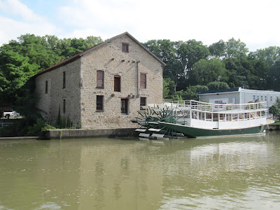 |
| Erie Canal |
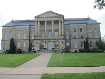 |
| Niagara County Courthouse, Lockport |
 |
| Upside Down Bridge, Lockport, NY |
Upside Down Bridge, called that because the support system is under the bridge rather than on top of the bridge. Building it like this allowed trains not to be concerned about the width of their loads and it was also a cost savings because the bridge didn't have to be so wide. It is rumored that it was built this way to limit the number of boats that could traverse the Erie Canal because the railroad didn't want to lose business.
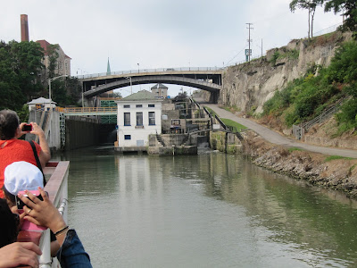 |
| Approaching Lock 34 |
 |
| The doors are closing behind us |
 |
| The "Big Bridge", the widest bridge in the U.S. - 399' wide and 129' long, built in 1914 |
 |
| This church, along the Erie Canal in Lockport, NY, was built by an Englishman for his wedding. He wanted a church like the ones in England and since there were none, he had this one built. |
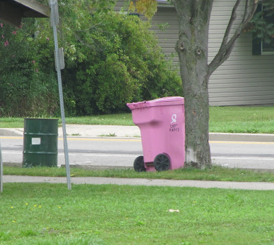 |
| I know pink is the color of Breast Cancer Awareness campaigns, but I've never seen pink garbage cans before, but they had them in Lockport |
 |
| John Roebling, builder/designer of the Brooklyn Bridge, lived in this house |
 |
| The "Flight of Five" locks, built in the 1860's, originally there were two sets of these locks but in the early 1900's when the canal was enlarged, one set was removed and this one was retained for use as a spillway. |
 |
| POISON IVY! Be on the lookout!!! |
 |
The "Cave" blasted out of solid rock, Lockport, NY. Water filled this tunnel and supplied the power to the manufacturing plants built on top of the tunnel.
|
 |
| All Saints Roman Catholic Church |
ONTARIO, CANADA
 |
| Niagara-on-the-Lake - this small town has beautiful flowers everywhere |
 |
| The Clock Tower in Niagara-on-the-Lake is dedicated to Canadians who died serving their country. |
 |
| Looking across the Niagara River at Fort Niagara in the U.S. |
 |
| Horseshoe Falls |
 |
| Rainbow over Horseshoe Falls |
 |
| The rainbows over the falls changed every minute or so. |
 |
| Looking at American Falls and Bridal Veil Falls from Canada |
 |
| Another rainbow, waiting for dark and the lighting of the falls |
 |
| OHHHH!!! |
 |
| AHHHH!!! |
 |
| WOW!!! |
LE ROY, NEW YORK
THE BIRTHPLACE OF JELL-O
Jell-O was "invented" in 1897 by Pearle Wait, a carpenter who wanted to earn money during the winter because there was no carpentry work. He came up with a fruit flavored gelatin that his wife named Jell-O. Because he didn't know how to market it, he sold his formula for $450 in 1899. With proper advertising and marketing, by 1902 Jell-O sales amounted to $250,000. As the saying goes "the rest is history".
 |
| The Jell-O Girl, introduced in 1904 |


