Friday, November 7, 2014

Heading South for the Winter

October 16, 2014

We’re going south for the winter!  The motorhome is packed so we’re heading to our winter stomping grounds in Baja California Sur, Mexico.  Our first stop will be at Castaic Lake RV Park in Castaic, California, where we will re-unite with our Canadian friends. Gord and Gwen, who we will travel to Baja with.  The RV park isn’t even near the lake and it wasn’t one I’d want to spend any time at but it was an okay stop for the night. There aren’t a lot of RV park choices in that part of California.  The next day we head south to Potrero County Park in Tecate, California, where we will spend the night before crossing the border into Baja California, Mexico.  While Gord and Gwen headed into Tecate to get their tourist visas stamped and get some pesos, we headed straight to the campground, planning to get the motorhome set up and then drive the Jeep into Tecate to take care of our visas.  Imagine our surprise when we drove into the campground and asked for a site for the night and were told there were no sites available.  Now, I could understand if there were RV’s parked all over the place but there was not even one RV in the whole park and they have about 100 sites!  We’ll never know what was happening because it was off to Tecate in the motorhome to find Gord and Gwen and then cross the border and spend our first night in Mexico.  We agreed to meet Gord and Gwen at either Rancho Sordo Mudo (an RV park that helps support the School for the Deaf) or Estero Beach RV Park in Ensenada.  The fact that Estero Beach had a hot tub and pool, not to mention a beautiful view, won out!  


On Saturday, October 18, we stopped in Catavina at Rancho Santa Ynez for the night, about 300 miles south of the California/Mexico border.  One more day of driving and we will be at the beach!  Total miles from our house to the beach - 1216!  One advantage to driving on the weekend is that there is much less truck traffic on Mex 1.  Although the highway has improved since we’ve been coming to Baja, there are many, many miles of narrow road.  Basically, the road is only about 19’ wide, motorhomes and trucks are 8-1/2’ wide plus mirrors that stick out so it can be a little harrowing, especially on the parts of road that have no shoulder.  It does keep you on your toes!!!

Before leaving home, I was a bit apprehensive about going to Baja this early because the high temperatures had been in the mid-90’s which doesn’t sound bad but coupled with humidity around 85%, that’s almost unbearable, at least to me.  We have been here for two weeks and it has been hot and humid, some days are more tolerable than others, the mosquitos and no-see-ums are having a heyday with my arms and legs covered in bites, and I’ve suffered through a week and a half of heat rash which has prevented me from spending more time in the water.  But, despite all that, I love it here!  

Two years ago when we arrived on Halloween, the beach was almost full (room for 20 +/- rigs).  This year, arriving on October 19, only our friends, Riky and Lawrence, were here.  Here it is, three days after Halloween and there are still only three rigs on the beach.  Even the vendors have been telling us there are very few tourists.  We did have a couple of dozen Trick or Treaters on Halloween doing their chant, “Tricky, tricky, Halloween”.  So cute!!!  There was a Halloween party at Armando’s Restaurant on Playa Santispac to end our day.

A stay at Playa Los Cocos isn’t complete without a hike up the Goodheart Trail.  It’s a well defined trail up a hill that takes us about 2 1/2 hours round trip.  It’s a good trail for our exercise routine.  We have been limiting our exercise because of the heat, but in a couple of weeks we won’t have an excuse!


Life on the Baja is so simple.  I guess that’s what we love about being here.  It’s refreshing to see the Mexicans take charge of their lives, not waiting for a handout.  After Hurricane Odile wreaked havoc earlier this year, they didn’t wait for the government to come clean things up, they did it themselves.  Unfortunately, this was the sixth hurricane in ten years, hopefully, the cycle will end soon and Mulege will be hurricane-free for many years.  When the weeds along the highway need to be cut, they do it by hand, some using machetes and a couple using gas-powered weed eaters!  I’m assuming these workers are paid by the government.  When a car got stuck in the sand on the road at Playa Los Cocos and the guys lent a hand to get it unstuck, we were all invited to attend a Baptism with a lunch to follow that was going to take place on the beach.  They made us feel like the guests of honor!  And, another day, when some other Mexican overnighters got stuck, Lee lent them Gord’s shovel.  The next day they asked to borrow some salt, then brought us ceviche they had just made, which is what they needed the salt for.  Such wonderful people!!!

Our lives on the beach continue as if the beach were full.  The ladies play cards at Bertha’s on Wednesday afternoon and while we may not play cards on the beach on Mondays as in the past, the six of us have a game day once a week.  Currently we only see the vendors if there are transients staying.  It’s amazing how the Mexican’s radar works, whenever one “strange” vehicle shows up, several vendors and/or the landlord shows up within a short time!  It just makes us laugh.  It doesn’t really take much to amuse us.  For instance, two young German couples and a single Canadian, also young, showed up one day.  It was interesting because the Germans did not know each other until about five days prior to arriving at Los Cocos although they had each been traveling for several months throughout Canada and the U.S. and were on their way to Guatemala.  And they met the Canadian a couple of days later.  One of the couples was using a Baja guidebook that said staying at Los Cocos might be free or there might be a charge, it just depended whether someone showed up to collect rent.  Wouldn’t you know?  Within the hour, someone was here collecting rent! And, at least one of the vendors showed up the next morning.

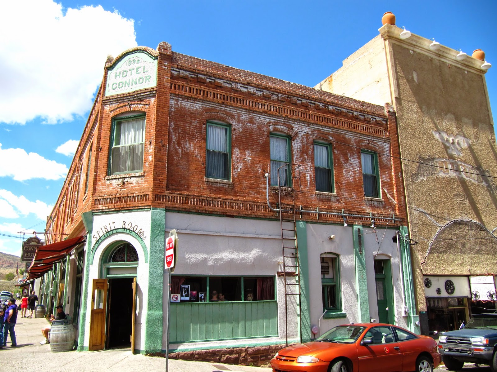
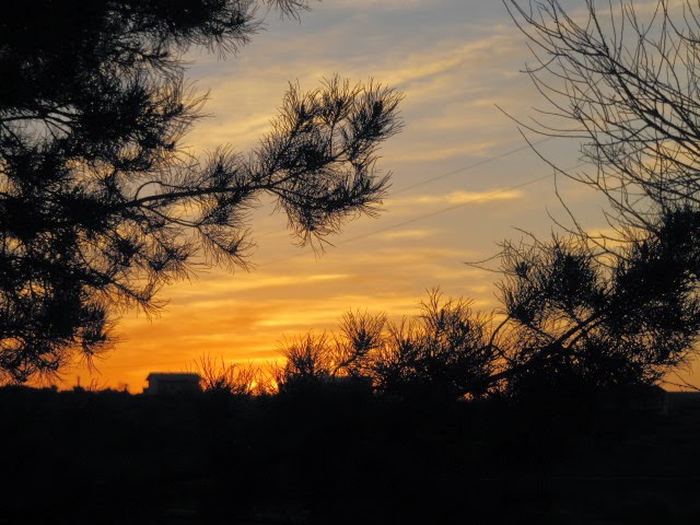
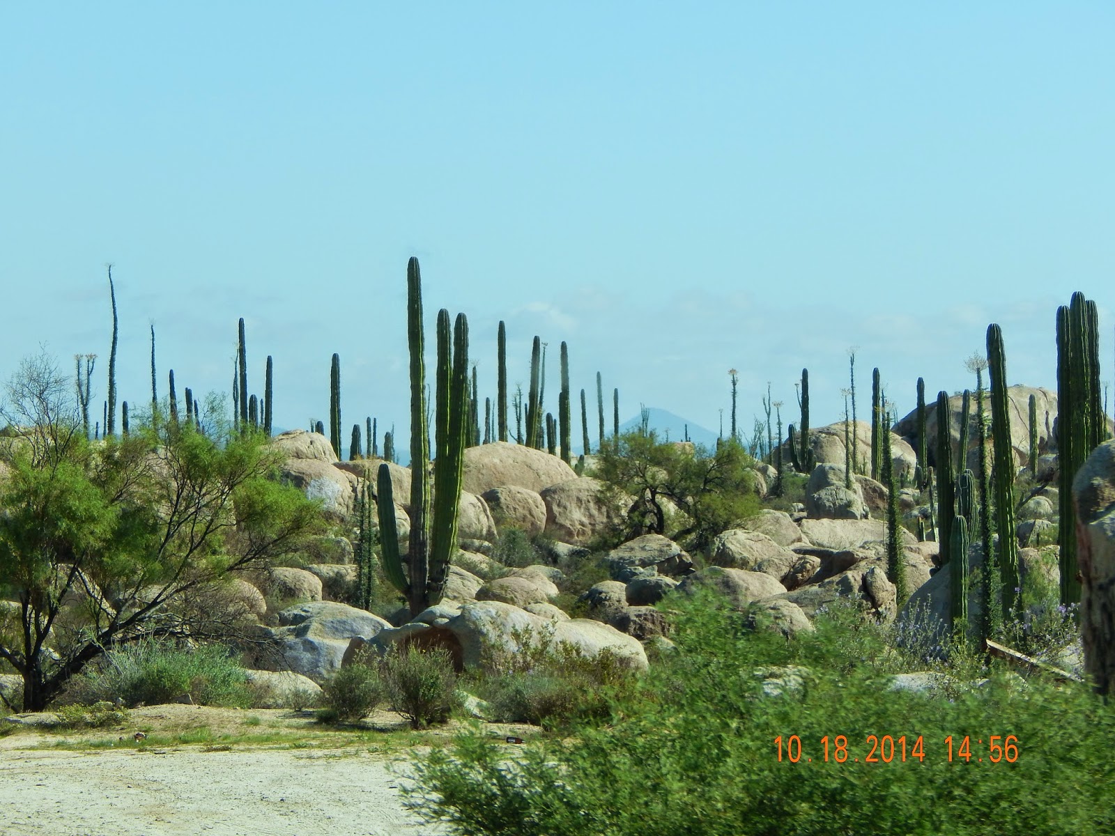
The following pictures were taken in various places along Mex 1in Baja California and Baja California Sur on our drive down to the beach.


A mountain peeking above a fog bank.
Approaching the Baja California Sur border


Cuesta Del Infierno
Mulege, Baja California Sur
Mulege, Baja California Sur

Mulege, Baja California Sur
Playa Santispac


Playa Los Cocos, Baja California Sur


Sunday, May 11, 2014

The Final Chapter

WARNING:  This is a rather long post.  I'm sorry for the length but I didn't want to leave anything out so I hope everyone enjoys it!

After leaving Hot Springs National Park on April 13, we headed to McKinney, Texas, just north of Dallas, to have our window shades replaced in the motorhome.  We still have over 2000 miles before we get home and 3 1/2 weeks to do it.  Do I sound a little anxious?

From Arkansas, we headed west into Oklahoma and rain, then south to McKinney while the rain continued.  So far we have been lucky to have missed the more severe weather that had been happening.  The week before, damage from wind and/or a tornado occurred in towns on either side of McKinney and a week after leaving more severe weather was predicted.  We are now in Cottonwood, Arizona and have had some pleasantly warm and sunny days until today, it's cold and rainy (April 26).

Amazing!  It has been almost a month since I started this.  I had planned to publish it by the time we left Verde Valley Thousand Trails in Cottonwood.  A number of Thousand Trails parks are a bit remote so internet isn't the best.  Although this park is near civilization, it is full of hills and valleys so Verizon didn't work so well and I just never got to the library to use their internet.  When I tried to upload some pictures, it was practically impossible so Lee took my computer to the top of a hill, downloaded them in no time, brought my computer back to me to work on my blog and I managed to lose everything he had just uploaded.  AAACCCKKK!!!  There are days when I really dislike computers.  So I put it away and decided to wait until I got home to write "The Final Chapter".  And now it has gotten to be very long!!!

McKinney, Texas is about 30 miles north of Dallas and was first settled about 1841 when the state of Texas hired colonizers to bring settlers into the area by offering free land, up to 640 acres, a gun and help building a cabin.

As I said, we were in McKinney to have the pleated window shades in the motorhome replaced with MCD roller shades.  So after having the windows measured and while we were waiting for the installation, we set off to do some sightseeing.

The Performing Arts Center, Historic McKinney, Texas

Historic downtown McKinney, Texas

Foote Baptist Church was built in 1908; when it was moved to its current location, the name was changed to The Chapel at Chestnut Square,  McKinney, Texas

John H. Johnson house, built in the early 1870’s.  He was a Captain in the Confederate Army and a politician.  His descendants occupied the house until 1987 when it was acquired by the Heritage Guild for restoration.  McKinney, Texas

Built in 1916 for Mrs. Joseph Dulaney, this is now the Dulaney Museum, McKinney, Texas

The only significance of Angel's Beverage Center in Plano, Texas (about 15 miles south of McKinney) is that when we decided to buy some liquor we couldn't find a liquor store in McKinney.  They do sell beer and wine in McKinney but not spirits because it is a dry city.  We knew about dry counties but not about dry cities.  It has been interesting traveling throughout the U.S. and encountering the numerous liquor laws which vary greatly by state.  Anyway, back to Angel's.  Plano also was a dry city until May, 2013, when the voters voted to sell liquor in Plano.  I guess they were tired of driving to Dallas to buy spirits!  Angel's was the first store in Plano to sell alcohol and it has been very popular ever since.  When the store first opened, they had to close their doors an hour before actual closing time in order to process all the customers.

Denison, Texas, supposedly named for one of my relatives.  If anyone can document the link, the local museum would love to have it!!!  Denison was also the birthplace of President Dwight D. Eisenhower on October 14, 1890.

The house where Eisenhower was born

Downtown Denison, Texas

Downtown Denison, Texas


St. Patrick Catholic Church, Denison, Texas

Our new shades were installed on Wednesday, April 16, 2014, and we love them!  We can now see out the windows without people looking in, unless the lights are on in the motorhome.  We left McKinney on Thursday and headed to Verde Valley Thousand Trails, Arizona, a 3-day drive in the motorhome.  A stop near Amarillo, Texas, had us checking out "The Big Texan" where one could get a free 72 oz. steak.  The catch is, one had to eat the steak and its accompaniments in one hour, and no sharing.  Success meant it was free, failure meant it cost $75.00!


Now that's one hunk of meat!

A chili pepper is more interesting than a slice of lime!

Getting closer to home

Now that is one bright pink overpass on Hwy. 40!  New Mexico

A more traditional looking overpass on Hwy. 40, New Mexico

April 19, 2014 - Snow still in the mountains around Flagstaff, Arizona

View from Verde Valley Thousand Trails, Cottonwood, Arizona

Verde Valley Thousand Trails, Cottonwood, Arizona


Historic Cottonwood, Arizona

The following pictures were taken in Jerome, Arizona, once a busy copper mining town founded in 1876.  Today's Jerome is a popular tourist town and artist community.  At one time, the mines produced three million pound of copper a month!


Jerome Town Hall

Blast furnace used in 1912.  According to a sign at the site, "This little furnace used coke for fuel.  The nearest source of supply was Wales, Gr. Brit. more than half way around the world in travel distance!  Small sailing vessels carried the coke across the Atlantic Ocean and around the Horn of South America to San Francisco.  From there it was transported by railroad to Ashfork, Arizona where it was loaded into mule drawn freight wagons and hauled 60 miles over the mountains to Jerome".  WOW!!!


Holy Family Catholic Church, built in 1894

Inside of Holy Family Catholic Church, built in 1894.

An interesting old movie projector


Another day we went to Slide Rock State Park, just north of Sedona.  It was beautiful and we were glad it was off-season.  It is a very popular place in the summer and the parking lot quickly fills up.  The park was originally a 43-acre apple orchard started when Frank L. Pendley acquired the land in 1910 under the Homestead Act and planted apple trees and developed an irrigation system that is still in use today.  There is a 1/2 mile stretch of creek bottom that has an 80-foot slide worn into the sandstone, plus numerous pools for wading.  I can imagine how crowded it gets in the summer when it really gets hot in Arizona.


Our last adventure while at Verde Valley TT was a first-class ride on the Verde Canyon Railroad.

Verde Canyon


After leaving Verde Valley we made one last stop in Arizona - visiting our friends Harold and Judi and Ron and Marilyn in Meadview, Arizona, which is about 60 miles north of Kingman.  We met all of them the first time we went to Baja, Mexico, in 2005.  

Stockton Hill Rd, north of Kingman, Arizona, on the way to Meadview

At Harold & Judi's in Meadview, Arizona, looking at the western edge of the Grand Canyon

Sunset in Meadview

We're home!  I must say, though, after seeing so many other "Welcome to . . ." signs, California's is rather boring!

After an overnight stay at the Elk's Lodge in Needles, California, we made our way to Paso Robles and our Blue Meanies RV Club campout.   We had a great time visiting with friends and we even did a little more sightseeing.  By this time we had less than a week before arriving home.  
Mission San Miguel Arcangel, founded July 25, 1797.  This church was built between 1816-1818.

The interior walls are the original paint which was made from ground minerals mixed with cactus juice!  Amazing!  The ingenuity of "primitive" people.

Mission San Miguel Arcangel, San Miguel, California

Mission San Miguel Arcangel, San Miguel, California

I would guess this tree has been backed into more than once!

Mission San Miguel Arcangel, San Miguel, California

San Miguel, California

The Pacific Ocean, Cambria, California

After leaving Paso Robles, we stopped in Modesto, California for two nights to visit our daughter and son-in-law and two grandkids.  We also visited with my sister and brother-in-law and my cousin and her husband.  And finally, on Wednesday, May 7, 2014, we arrived home!  We had been on the road for 9 months and 1 week and added 12,500 miles to the motorhome.  We also drove our Jeep another 8,000 sightseeing!  It was an excellent trip but now we're ready to stay home for a little while.  At least until November or December and we take off to Baja for the winter.  We'll probably take a few short trips during the summer.  Then next year, we plan to take off to Alaska again.

THE END!!!